Field notes
Useless’s field notes, with the official disagreements left in.
Conversion errors, satellite versus screen, two dates on one Dry Valleys image, and two official mile figures for the same ice-sheet threshold.
Useless keeps a notebook of official disagreements, odd captions, and things this desk refused to tidy away.
−89.2 °C, not −89.4 °C
The WMO Vostok page itself explains the discarded figure as a likely round-trip conversion through −129 °F. [source] We quote that explanation; we do not keep both numbers as if they were two official records.
Air at Vostok, and snow under a satellite
NASA’s 2013 land-surface figure and NSIDC’s 2018 revision are not used to “update” the WMO air record. They are later, different measurements, and they are dated as such. [source] [source]
8 December 2002, and 4 December 2009
NASA Science says the Dry Valleys Terra image was acquired on 8 December 2002. [source] The Commons file page for the ASTER still we use gives the date 4 December 2009. Both dates appear in the caption. We do not pick one in secret.
19,300 square miles, or 20,000
NSIDC’s ice-sheet threshold is 50,000 square kilometres on both pages we opened. The mile figures differ. [source] [source]
A file once labelled GISP2
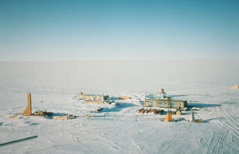
A related ice-core team photograph, used on the ice-ages site, has a Commons title that says GISP2, and a file description that says it is actually the Vostok team. That argument is left on ice-ages.climates.im, where the cores belong. The Vostok panorama on this site is the NOAA / Todd Sowers picture of the camp itself.
What this desk is not
It is not tundra.climates.im, not deserts.climates.im, not climate-change.climates.im, and not storms.im. Those sisters are linked, not copied.
Enjoyed a desk of official cold records, ice caps, and a night that lasts a season?
No pop-ups. No intrusive advertising. Just interesting stuff. A little support helps the next climates.im site get built.