Credits
Every photograph on this site
Licences were checked on each source page on 18 November 2026. Most stills are public-domain photographs from NASA, the National Science Foundation, NOAA and Herbert Ponting. Two stills are used under CC BY 2.0 and CC BY 4.0 and are credited as such.
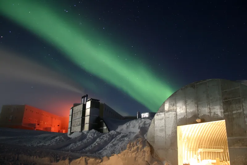
Amundsen-Scott South Pole Station during the long Antarctic night, July 2005. The National Science Foundation caption says a full moon and a 25-second exposure let in enough light; the new station is at far left, the power plant in the centre, and the old mechanic’s garage at lower right. Red lights are used outside in winter so their spectrum does not pollute the sky for astrophysics. The green background, the same caption says, is the Aurora Australis, which “dances through the sky virtually all the time during the long Antarctic night (winter).” Photo: Chris Danals, National Science Foundation · Public domain · NSF / Chris Danals / Wikimedia Commons 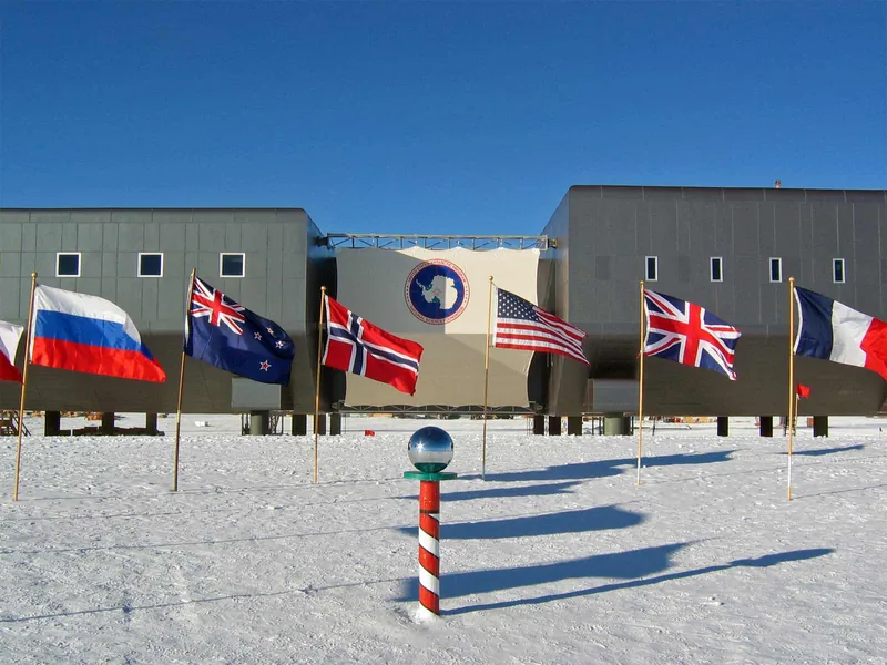
Amundsen-Scott South Pole Station in the 2007–2008 summer season, photographed by Bill Spindler of the U.S. Antarctic Program. The file caption says the new elevated station is complete, and that the ceremonial South Pole and the flags of the original 12 signatory nations to the Antarctic Treaty stand in the foreground. Photo: Bill Spindler, U.S. Antarctic Program, National Science Foundation · Public domain · NSF / USAP / Bill Spindler / Wikimedia Commons 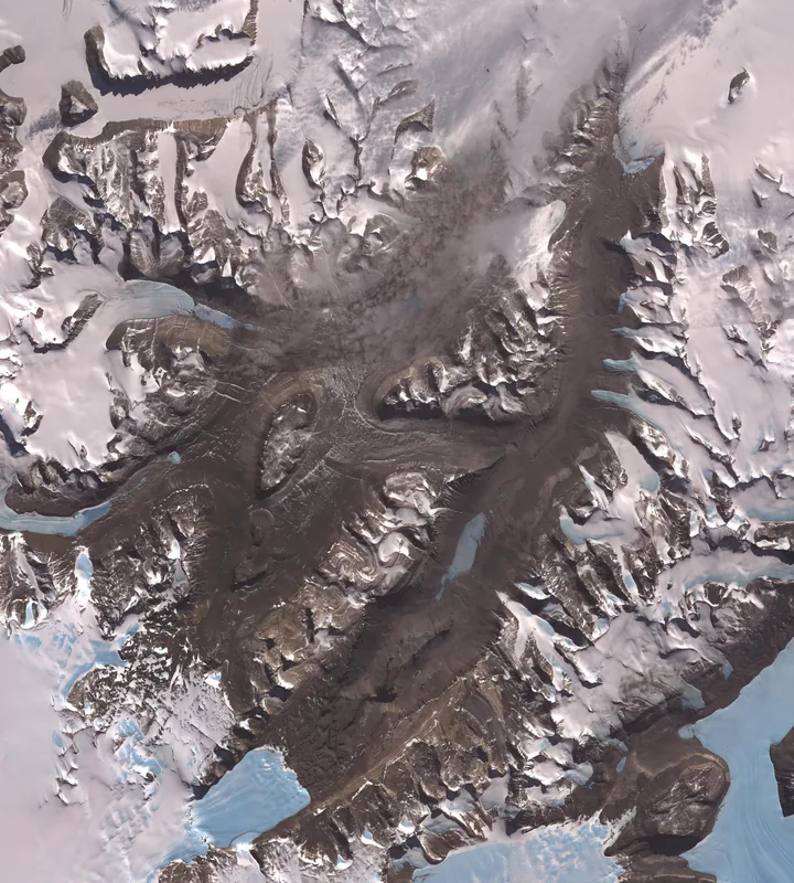
The McMurdo Dry Valleys, west of McMurdo Sound. NASA Science’s photojournal page says they are so named because of their extremely low humidity and lack of snow and ice cover, and that this Terra image was acquired on 8 December 2002. The Wikimedia Commons file page for the same ASTER still gives the date 4 December 2009. Both dates are left as they appear; they are not averaged. Satellite image: NASA/GSFC/METI/ERSDAC/JAROS, and the U.S./Japan ASTER Science Team · Public domain · NASA/GSFC/METI/ERSDAC/JAROS / ASTER Science Team / Wikimedia Commons 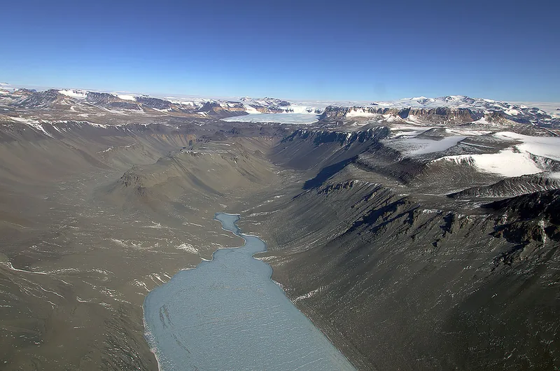
Wright Valley, photographed on 19 November 2013. The file is titled Wright Valley and is used here as a ground-level look at one of the McMurdo Dry Valleys, beside the official Terra image. Photo: Michael Studinger · Public domain · Michael Studinger / Wikimedia Commons 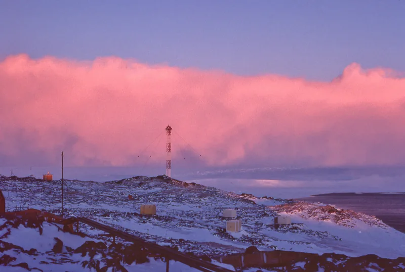
The file caption: a katabatic wind approaching the coast of Adélie Land, at Dumont d’Urville station, Antarctica, in 1977. “Photo taken in winter, with a low-setting sun, which enhances a pink colour for the snow cloud.” Used under CC BY 4.0. Photo: Pepys · CC BY 4.0 · Pepys / Wikimedia Commons 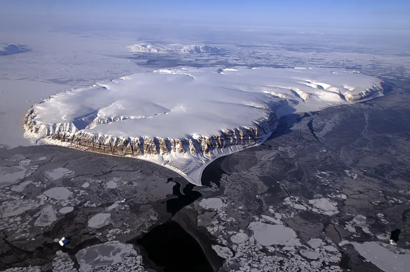
Saunders Island and Wolstenholme Fjord, Greenland, with Kap Atholl in the background, photographed during a NASA Operation IceBridge survey flight in April 2013 by Michael Studinger. The official caption notes sea ice from thicker white ice in the background to thinner grease ice and leads of open water in the foreground. Photo: NASA / Michael Studinger · Public domain · NASA / Michael Studinger / Wikimedia Commons 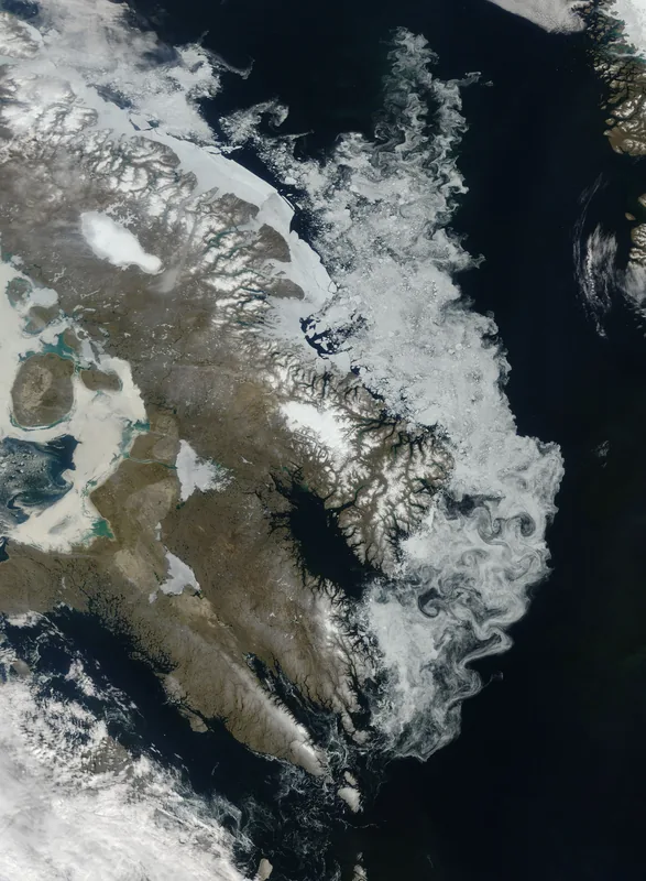
Winter ice hugging the coastline of Baffin Island, in a natural-colour image dated 30 July 2009, by Jeff Schmaltz. The file caption says clouds often hover over the Arctic in the Northern Hemisphere summer, so a cloud-free view like this is relatively rare, and that eddies along the coast have fashioned the ice into interlocking swirls. Satellite image: Jeff Schmaltz · Public domain · Jeff Schmaltz / Wikimedia Commons 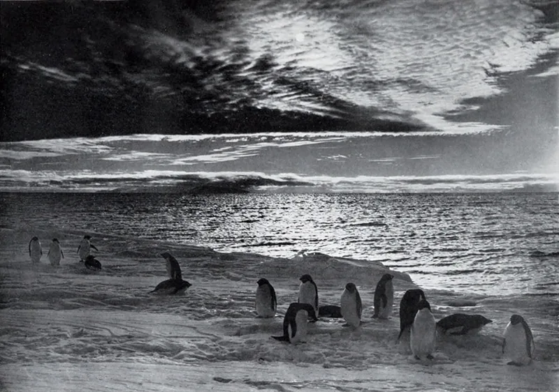
“The Midnight Sun in McMurdo Sound,” photographed by Herbert Ponting on the Terra Nova Expedition in 1911, and published in Scott’s Last Expedition in 1913. Photo: Herbert Ponting · Public domain · Herbert Ponting / Wikimedia Commons 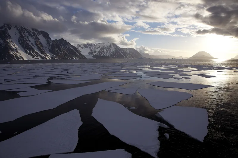
Midnight sun in Antarctica, 25 December 2008, by Jason Auch. The original caption: “This is as close as the sun came to setting today. 24 hour daylight in the summer.” Used under CC BY 2.0. Photo: Jason Auch · CC BY 2.0 · Jason Auch / Wikimedia Commons 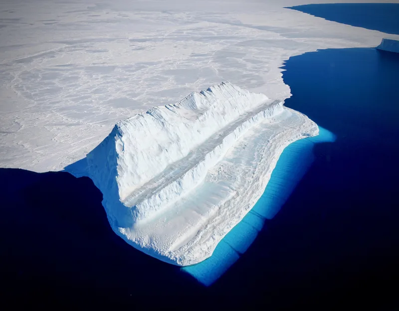
An iceberg in McMurdo Sound, photographed on 29 November 2017 by Chris Larsen during a NASA Operation IceBridge flight to Victoria Land. The official caption says the part of the iceberg below water appears bluest primarily because of blue light from the water, and describes the berg’s unusual step-like shape. Photo: Chris Larsen, NASA Operation IceBridge · Public domain · NASA IceBridge / Chris Larsen / Wikimedia Commons 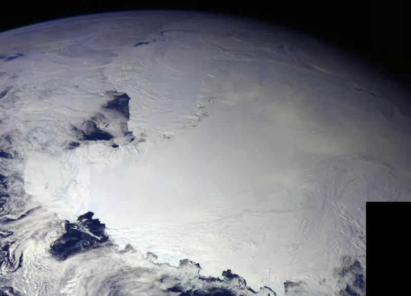
The Ross Ice Shelf, in a colour picture taken by the Galileo spacecraft on 8 December 1990, after its first encounter with Earth. NASA/JPL’s caption says an occasional mountain can be seen poking through the ice, and that it is late spring in Antarctica, so the sun never sets on the continent. Spacecraft image: NASA/JPL · Public domain · NASA/JPL / Wikimedia Commons 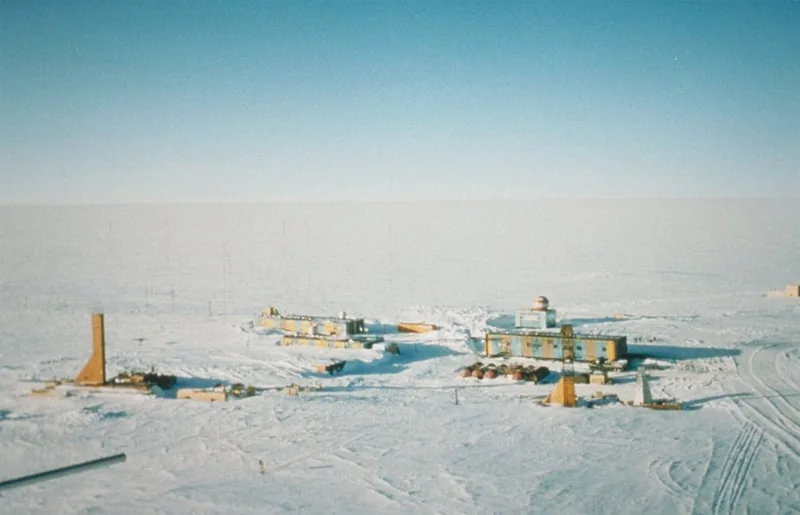
Vostok Station, photographed by Todd Sowers of Lamont-Doherty Earth Observatory for NOAA, dated 11 October 2001 on the file. The caption says the site was chosen by the Soviet Union for deep coring; French and later American scientists joined the work. The striped building on the left is the power station, the one on the right is where researchers sleep and take meals, and the building with a red-and-white ball is meteorology. Caves dug into the ice sheet, the same caption says, kept cores at −55 °C year round. Photo: Todd Sowers, Lamont-Doherty Earth Observatory, for NOAA · Public domain · NOAA / Todd Sowers, LDEO / Wikimedia Commons
Enjoyed a desk of official cold records, ice caps, and a night that lasts a season?
No pop-ups. No intrusive advertising. Just interesting stuff. A little support helps the next climates.im site get built.